



Hwaseong Creates Comprehensive 'Fire Risk Map' Across Entire City...Fires Concentrated in Sprinkler Dead Zones
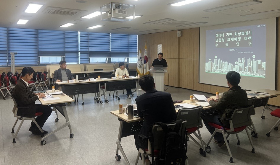
Hwaseong Special City has created a 'fire risk map' based on data regarding sprinkler dead zones and distribution of fire prevention facilities.
The effort aims to pre-diagnose fire risks through GIS spatial analysis to establish quantitative evidence regarding fire risk factors, and to shift from reactive response to preventive, data-driven fire management systems.
On the 28th, Hwaseong Special City held an interim reporting session on 'establishing customized fire prevention measures for Hwaseong Special City based on data' at Hwaseong City Research Institute, attended by city officials, the Hwaseong Fire Department, and officials from Hwaseong City Research Institute.
The research conducted through collaboration between the city and Hwaseong Research Institute divided the entire Hwaseong city area into grids of 500m×500m, calculated fire risk scores for each grid, and displayed them on a map. This approach is the first of its kind in the nation.
The analysis utilized key factors related to fire risk. The major factors include ▲buildings in dead zones where sprinkler installation status is unclear, as permits were granted before standards were strengthened ▲small-scale buildings excluded from mandatory automatic fire suppression system installation ▲piloti-structured buildings with open layouts that pose risks of fire spreading to upper floors.
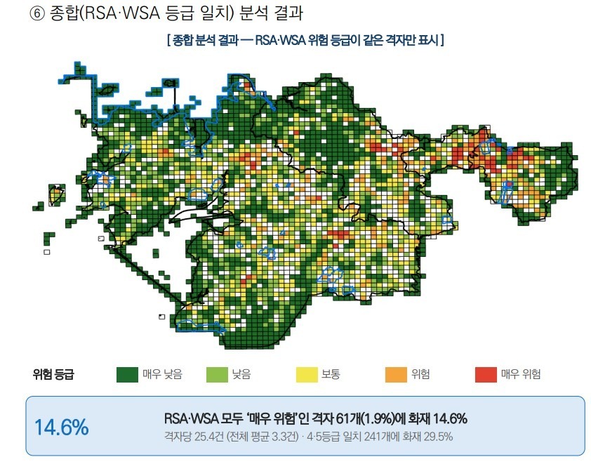
Survey results showed that 55.6% of fires were concentrated in the top 20% of grids with the highest fire risk. Notably, the city identified 741 buildings in 'sprinkler dead zones.' Regions with such buildings were concentrated 94% in the top 20% of grids, and the number of fires in dead zones was more than five times higher than the average number of fires in grids without dead zones.
Based on the research findings, the city decided to establish fire prevention policies. Directions include prioritizing fire inspections in high-risk areas, reviewing designation of 'fire prevention reinforcement zones' (if necessary), and conducting comprehensive surveys of sprinkler dead zones.
Countermeasures under discussion include amending ordinances and laws to support sprinkler installation costs for dead zone buildings, promoting basic fire prevention facilities in buildings with floor areas of 600㎡ or less and piloti buildings, and establishing a drone-based fire response system.
Mayor Jung Myung-geun of Hwaseong Special City stated, "Through this research, we can now precisely identify which buildings and alleys are actually at risk," and added, "To ensure citizens can live with peace of mind, we will meticulously inspect high-risk areas first and implement practical measures such as sprinkler support."



Loading comments…